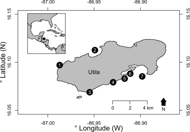
Fig 1. Map of study sites around Utila, Honduras.
Survey locations are marked, with numbers indicating sites as follows: (1) Spotted Bay, (2) The Maze, (3) Stingray Point, (4) Little Bight, (5) Black Coral Wall, (6) Coral View and (7) Lighthouse Reef. Inset map shows the location of Utila relative to the Caribbean region. Map sourced from GADM database of Global Administrative Areas under a CC BY licence with permission.

