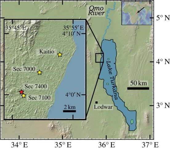
Figure 1.

Map shows the study area and sampling sites of the Nachukui Formation along the northwestern margin of Lake Turkana. Stars indicate the locations of sampled sections in the Kalocholoro and Kaitio Members. The red star indicates the location of archaeological site KS4 where the oldest Acheulean tools were found [2,3]. Base map is from GeoMapApp [43].
