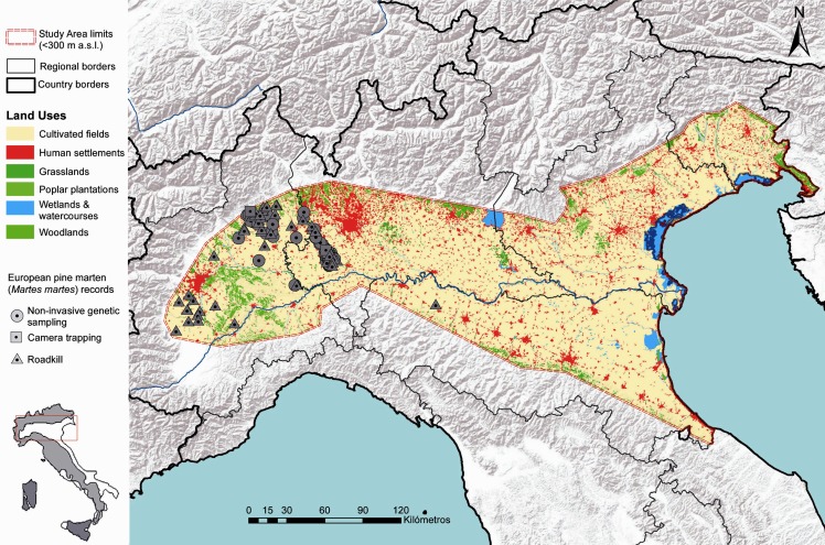
Fig 1. Map of the study area (i.e. the Po-Venetian alluvial plain, < 300 m above sea level) corresponding to the potential expansion range of the pine marten in northern Italy.
Pine marten locations are denoted by black triangles (N = 103). Black lines indicate regional borders. The distribution range of the pine marten in Italy is shown in the upper-right corner. Base Map used: World Terrain Base; data sources: Esri, USGS, NOAA; Reprinted from PLOS ONE under a CC BY license, with permission from ESRI, original copyright June 2009.

