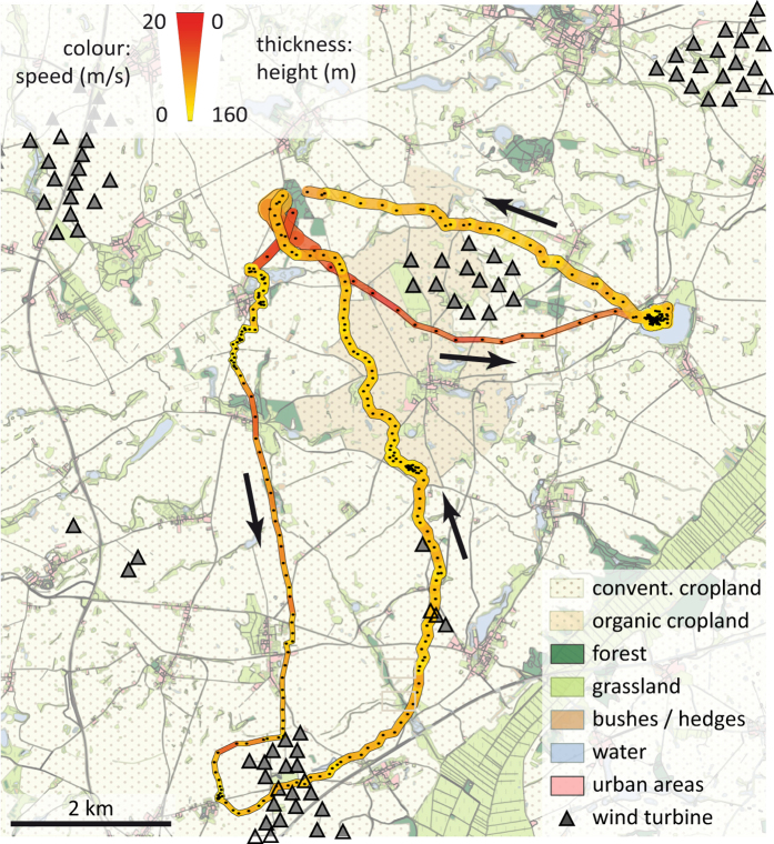
Figure 2. Exemplary evening flight paths of a female (lower path) and male (right path) N. noctula.
Colour and thickness of paths code for flight speed and flight height. Black dots within paths depict recorded GPS locations. Black arrows depict the overall flight direction. The map was created with ArcGIS Desktop 10.2 (ESRI Inc, USA, http://www.esri.com/apps/products/download/) using data from39,40.

