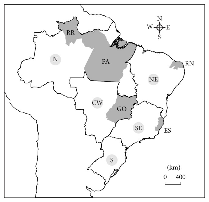
Figure 1.

Brazilian map with the states used in the study in grey. RR: Roraima; PA: Pará; RN: Rio Grande do Norte; ES: Espírito Santo; and GO: Goiás. The continuous lines indicate the different regions of the country. N: north; NE: northeast; SE: southeast; S: south; and CW: central-west.
