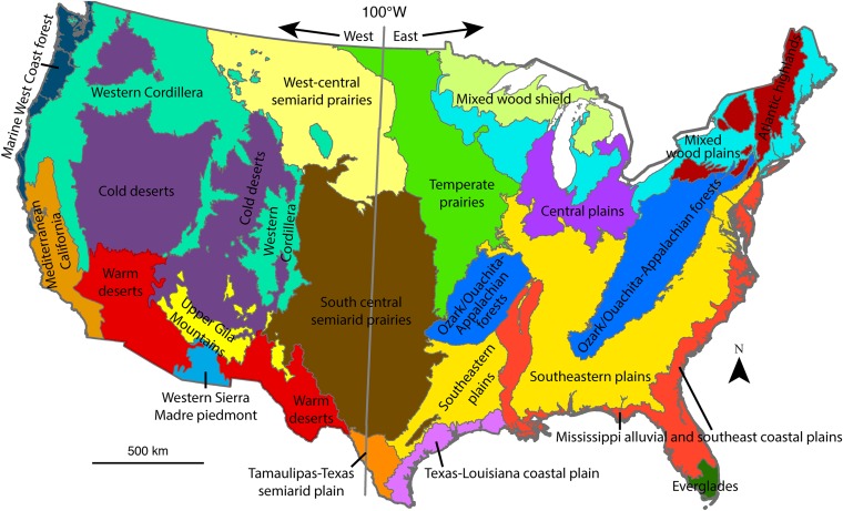
Fig. S5.
Geographic and ecological divisions. We used the 100°W longitudinal line to divide the arid West from the moister, eastern United States. Colored divisions represent the 20 level II Environmental Protection Agency ecological regions used for analyses (47).

