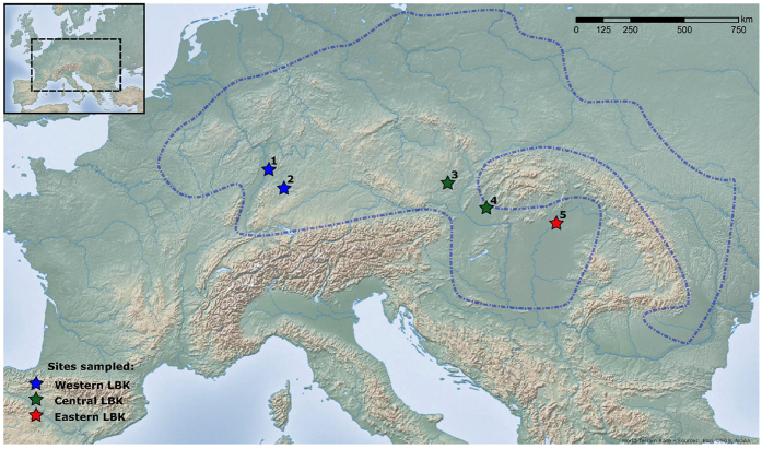
Figure 1. Location map for populations used in this study, showing the regional grouping of sites.
See Supplementary Table S2 for more detail. 1 - Schwetzingen; 2 - Stuttgart-Mühlhausen; 3 - Vedrovice; 4 - Nitra-Horné Krškany; 5 - Polgár-Ferenci-hát. World Terrain Base map ( http://tiles.arcgis.com/tiles/jIL9msH9OI208GCb/arcgis/rest/services/World_Relief_Map/MapServer) from ArcGIS [version 10.1], ( http://www.esri.com/software/arcgis).

