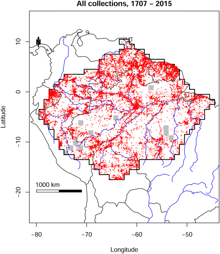
Figure 1. Collection localities of herbarium specimens of Amazonian trees, collected between 1707 and 2015, for which geographical coordinates were available and considered reliable.

Grey squares are 1-degree grid cells that contain no collections. Map created with custom R script. Base map source (country.shp, rivers.shp): ESRI (http://www.esri.com/data/basemaps, © Esri, DeLorme Publishing Company).
