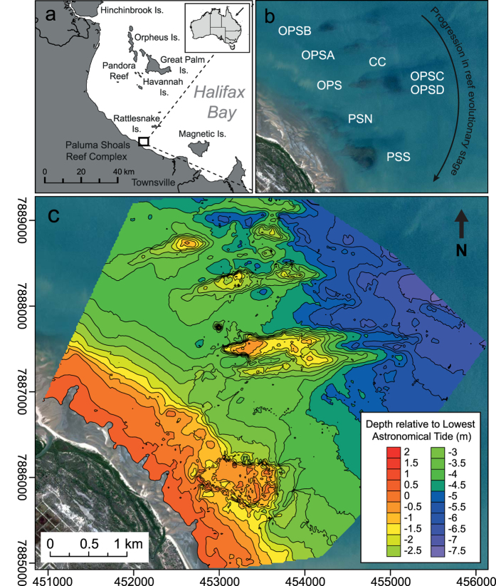
Figure 1.
(a,b) Paluma Shoals Reef Complex (PSRC) located within Halifax Bay, central Great Barrier Reef, Australia (PS: Paluma Shoals [North & South], OPS: Offshore Paluma Shoals, OPS [A,B,C,D]: Offshore Paluma Shoals [A,B,C,D], and CC: coral carpets). Australian boundaries were imported into ArcMap 10.2.2 (http://www.esri.com/) from the database of Global Administrative Areas (GADM) which is freely available for academic use (http://gadm.org/). (c) Seafloor bathymetry (co-ordinates in Australian Map Grid) of the nearshore survey area (15.5 km2) generated from single-beam acoustic survey data (contours are at 0.5 m intervals relative to lowest astronomical tide). Contour map was generated in Golden Surfer 12 (http://www.goldensoftware.com/). All maps were modified in Adobe Illustrator Version CS5 (http://www.adobe.com/). WorldView-2 satellite imagery is courtesy of the DigitalGlobe Foundation (http://www.digitalglobefoundation.org/).

