
Fig 2. Example of deforestation site analysis within an oil palm plantation in Bawat, West Kalimantan, Indonesia.
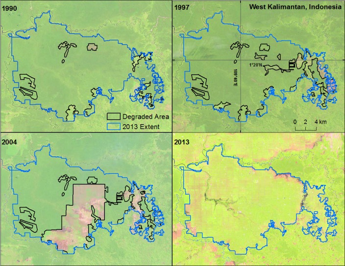
Each panel represents one sample year, with the deforested area in that year outlined in black and the 2013 oil palm planted area outlined in red. Imagery from Landsat 5 TM (1990, 1997 and 2004) and Landsat 8 (2013).