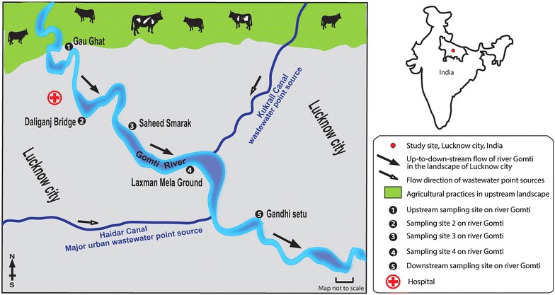
Fig. 1.

Map of study area/sampling sites in the landscape. Abbreviations: S#1, site 1: Gau-Ghat (the most upstream site), S#2, site 2: Daliganj Bridge, S#3, site 3: P Shaheed Smarak, S#4, site 4: Lakhshaman mela ground, S#5, site 5: Gandhi setu (the most downstream site). Black-and-white arrows indicate the direction of river water and wastewater flow in the up-to-downstream in the landscape respectively. Topographic data based upon Survey of the map of India
Adopted from www.ttkmaps.com
