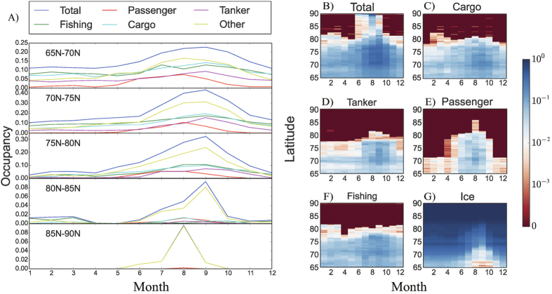
Figure 4. Shipping per latitude, month, and vessel type.
(A) Percentage of area covered by ships as a function of month for latitude in the range 65–70oN, 70–75oN, 75–80oN, 80–85oN, and 85–90oN. (B–F) Percentage (in logarithmic scale) of area covered by ships per month, latitude, and vessel type: total (B), cargo (C), tank (D), passenger (E), and fishing (F). (G) The percentage of ice coverage with month.

