
Fig. 3.
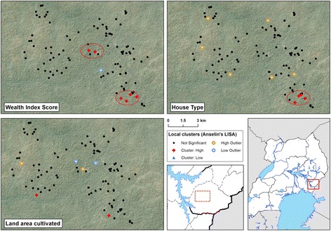
Local cluster maps of wealth index score, house type and cultivated land area in 100 households in Nagongera, Uganda. Maps show results from univariate Local Indicator of Spatial Association (LISA) analysis. A cluster of high wealth index scores overlapping with a cluster of modern housing is located in the south-east of the study area. Houses were classified as modern (cement, wood or metal walls; a tiled or metal roof and closed eaves) or traditional (all other houses). Wealth index score and land area cultivated were modelled as continuous variables