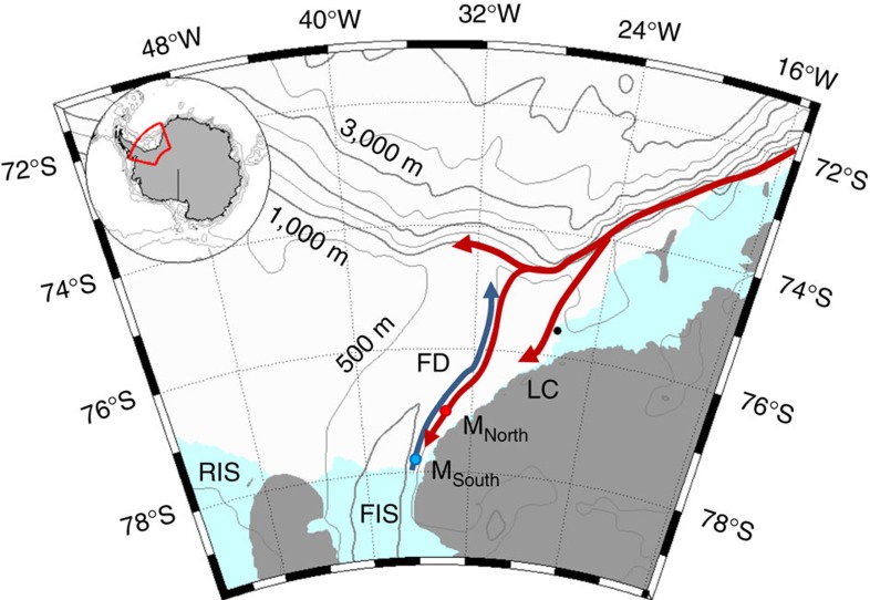
Figure 1. Map.
Location map shows the moorings (coloured dots), Halley station (black, 75°35′ S, 26°34′ W), bathymetry27 and the circulation in the area6,17: the blue arrow indicates the flow of cold ISW towards the Filchner sill and the red arrows the path of the coastal/slope front current. The indicated place names are: Filchner Depression (FD), Filchner Ice Shelf (FIS), Luipold coast (LC) and Ronne Ice Shelf (RIS).

