
FIGURE 11.
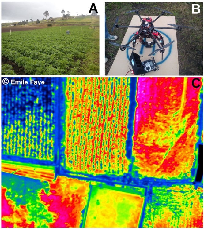
Remote sensing data of temperature collected using drone technology. (A) Potato crop field in Ecuador where thermal images were collected. (B) RC-drone PIXTIM, DJI Wookong-M autopilot with GPS receptor and 12 min flight autonomy used for data collection. (C) Resulting temperature image at 2 cm spatial resolution. Images courtesy: Danilo Yanez and Emile Faye. © Emile Faye – IRD.