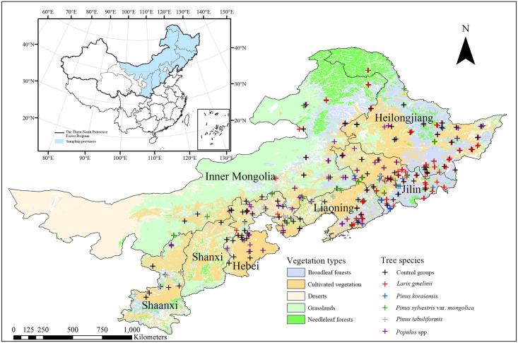
Fig 1. Map of the study area.
The locations of sampling sites surveyed during 2012–2013 are marked with “+” symbols. The texts displayed refer to the name of provincial administrative unit, which are Inner Mongolia Autonomous Region, Shaanxi Province, Shanxi Province, Hebei Province, Liaoning Province, Jilin Province and Heilongjiang Province, respectively. Land cover map was adapted from the vegetation distribution map of China [28].

