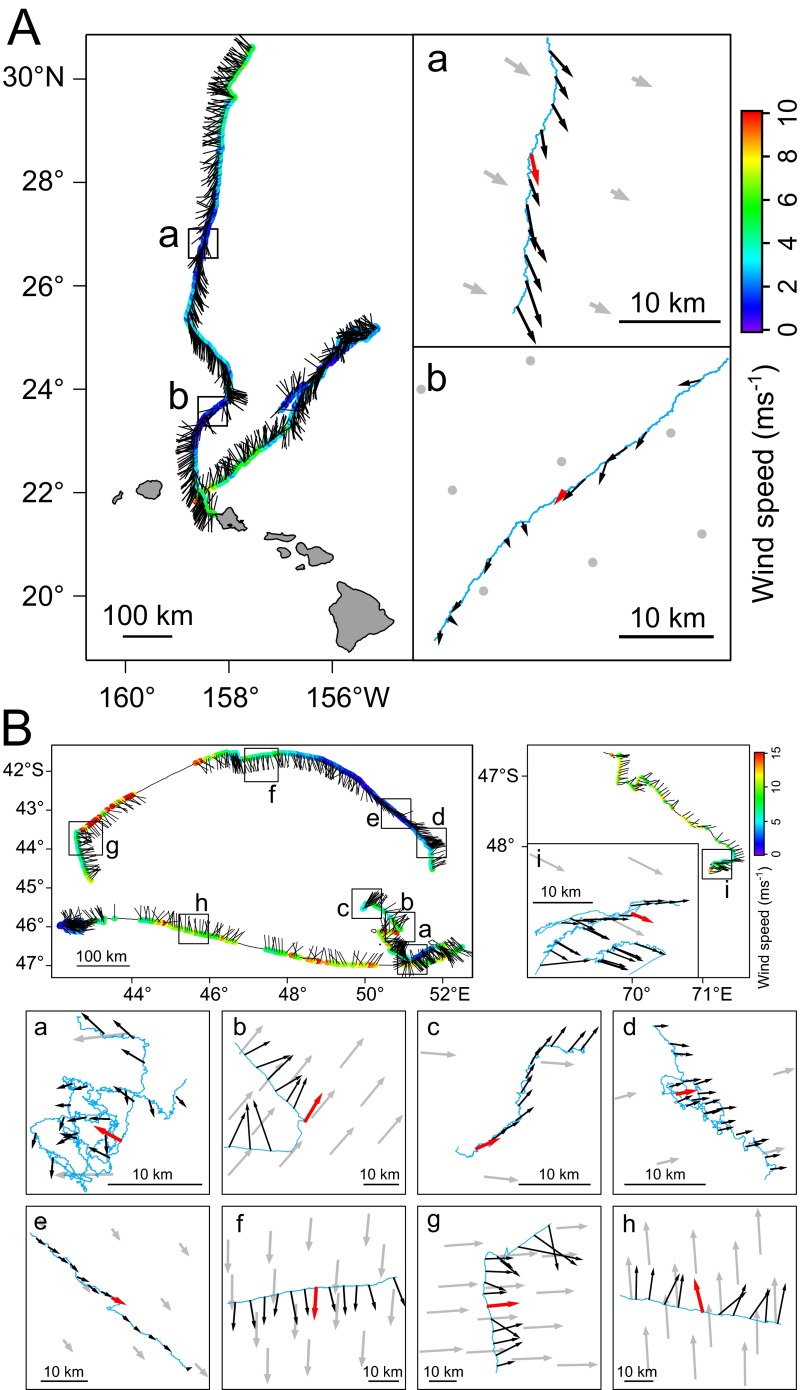
Fig. S2.
(A) Bird-based winds are mapped on the flight paths of two Laysan albatrosses and (B) four wandering albatrosses. Colors on the flight paths indicate the estimated wind speed. Black bars indicate the direction to which the wind is blowing. Points where bird-based winds were compared with satellite-based winds are shown in boxes. Blue lines are the bird’s flight path, and black arrows are the bird-based winds with length of the arrows indicating wind speed. Red arrow in the boxes represent the bird-based winds temporally closest to the satellite-based wind measurements shown in gray arrows.

