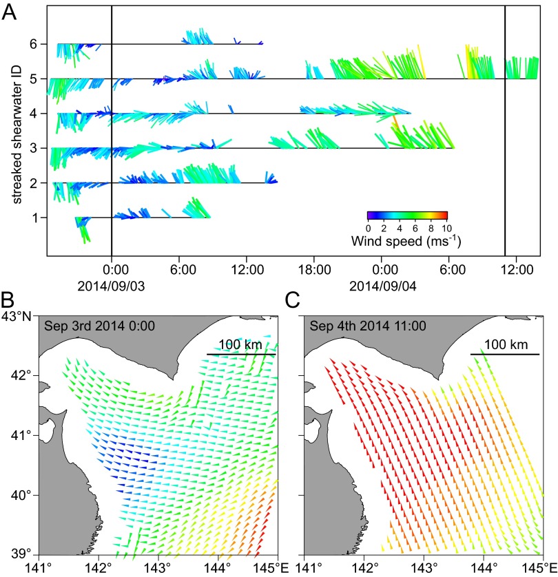
Fig. S7.
(A) Temporal view of the bird-based winds by six streaked shearwaters released on September 2, 2014. Two black vertical lines indicate the times when a satellite scatterometer estimated the wind in the sea of northeastern Japan. (B) The satellite-based wind on ∼0:00 UTC of September 3, 2014, and (C) 11:00 UTC of September 4, 2014. There are data gaps at the coastal area and outside the measurement band.

