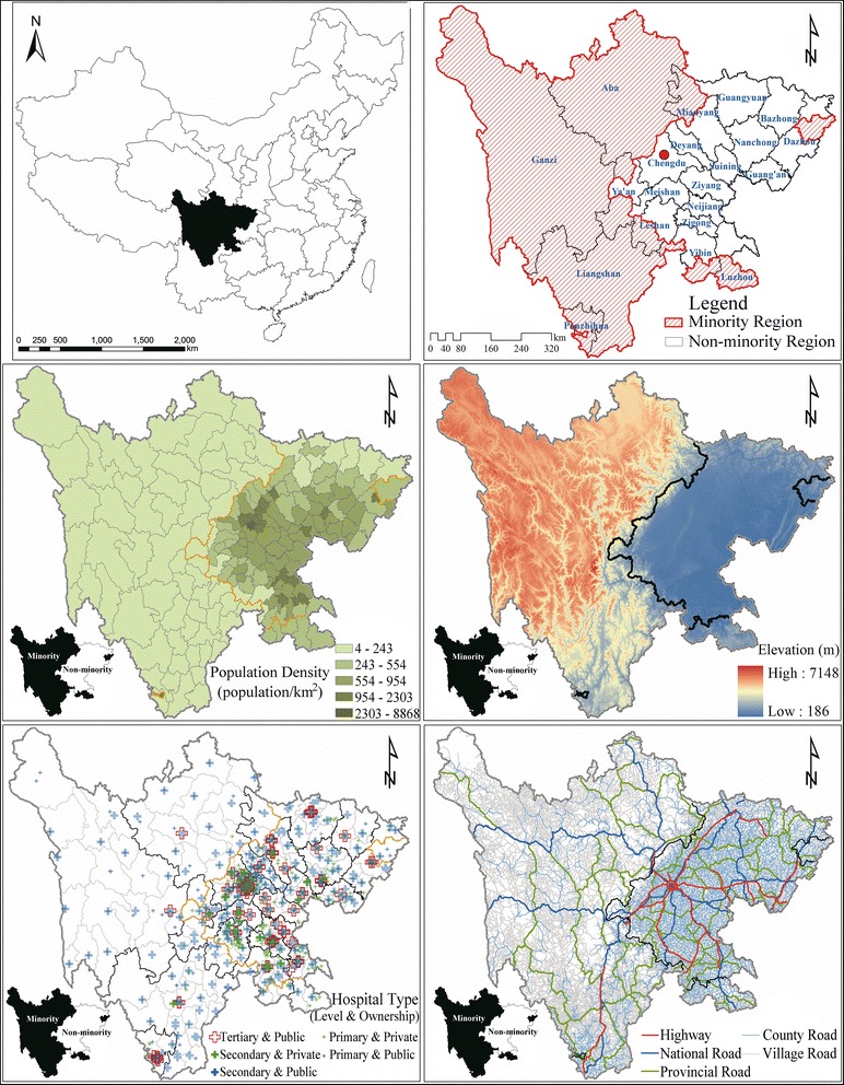
Fig. 1.

Population, transportation, ethnic minority region, and hospital distribution in Sichuan Province, 2012. Note: Based on the data collected from the Health and Family Planning Commission of Sichuan Province (hospital data), the National Geomatics Center of China (digital elevation model, administrative boundary and road network data), and the department of the Statistics Bureau of Sichuan (population and county type data), the listed maps were developed under ArcGIS 9.3 environment
