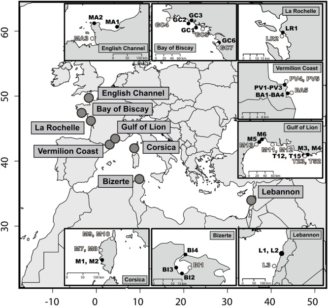
FIGURE 1.

Map of the 46 sediments sampling stations. At each location a priori non-contaminated sites are in light gray and a priori contaminated sites in black. The x-axis and y-axis stand for decimal longitude and latitude, respectively.

Map of the 46 sediments sampling stations. At each location a priori non-contaminated sites are in light gray and a priori contaminated sites in black. The x-axis and y-axis stand for decimal longitude and latitude, respectively.