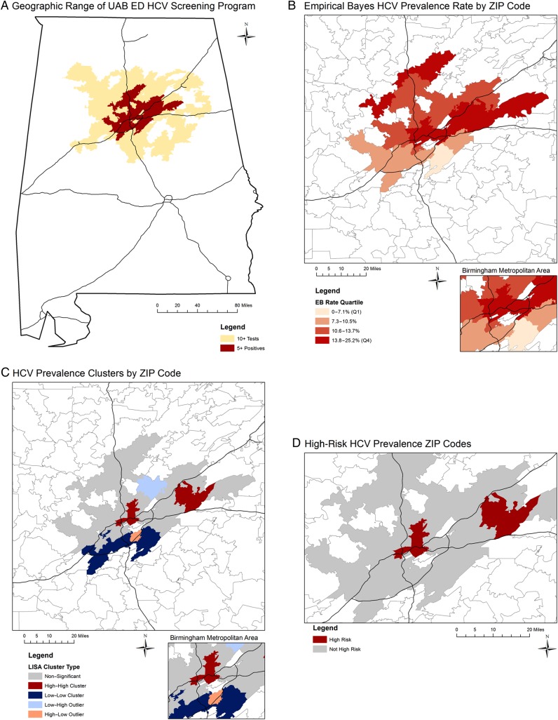
Figure 1.
Geographic distribution of hepatitis C virus prevalence in central Alabama by ZIP code. Geospatial analysis includes tests performed from 2013 to 2015 at the University of Alabama at Birmingham Emergency Department. Analysis was limited to ZIP codes with at least 10 tests; data are not shown in maps for ZIP codes with fewer than 5 positives. Black lines represent major interstate highways. Abbreviations: EB, empirical Bayes; ED, emergency department; HCV, hepatitis C virus; LISA, local index of spatial autocorrelation; UAB, University of Alabama at Birmingham.

