
Figure 1.
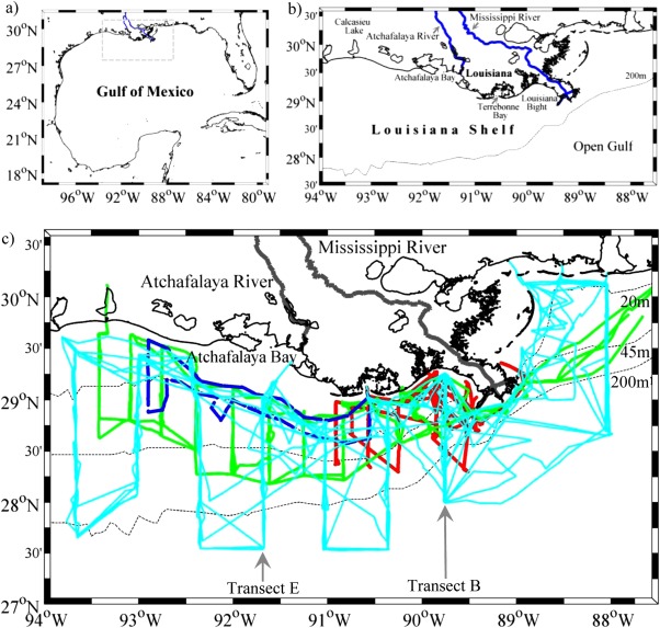
Study area and cruise tracks. The study area was in the northern Gulf of Mexico (the gray rectangular in plot) which was enlarged in plot (b) to display geographic setting of the Mississippi and Atchafalaya River system and various coastal bays and estuaries. The cross‐shelf area (light blue lines) was surveyed during 2009–2010 (c). The shelf‐wide area (green lines) was surveyed during June 2006–2007 (c), and this area was used as a reference area to unify the shelf‐wide and cross‐shelf survey areas when discussing air‐sea CO2 fluxes. The Louisiana Bight and its adjacent areas (red lines) were surveyed from 2004 to June 2006 (c). The inner shelf (dark blue lines) was surveyed in 2008 (c).