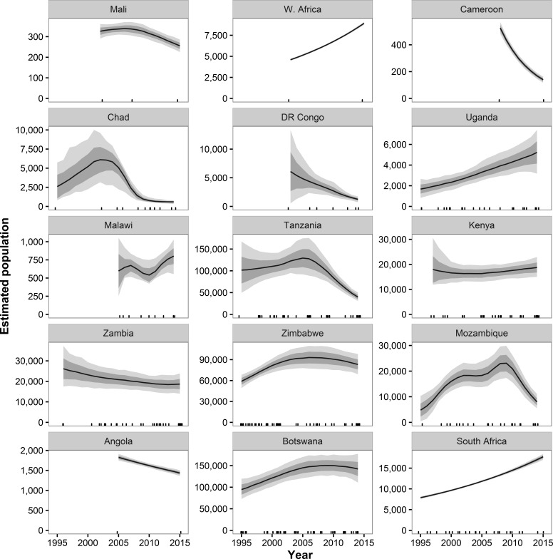
Figure 3. Estimated population trends in GEC study areas by country for sites with historical data available.
Results are based on 1,000 Monte Carlo replicates for each country. Dark shaded area indicates ±1 SD; light shaded area indicates 95% confidence interval. Tick marks on x-axis indicate dates of data points used in model; dates may be perturbed slightly to prevent overlap. “W. Africa” refers to the WAP ecosystem in Benin, Burkina Faso, and Niger.

