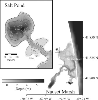
Figure 1.

Bathymetric map of the Nauset Marsh system. A shallow central marsh area connects Salt Pond to the Atlantic Ocean via a narrow inlet while also isolating its A. fundyense blooms. Inset: Salt Pond bathymetry. The IFCB support raft was installed near the pond's central hole (marked by white cross).
