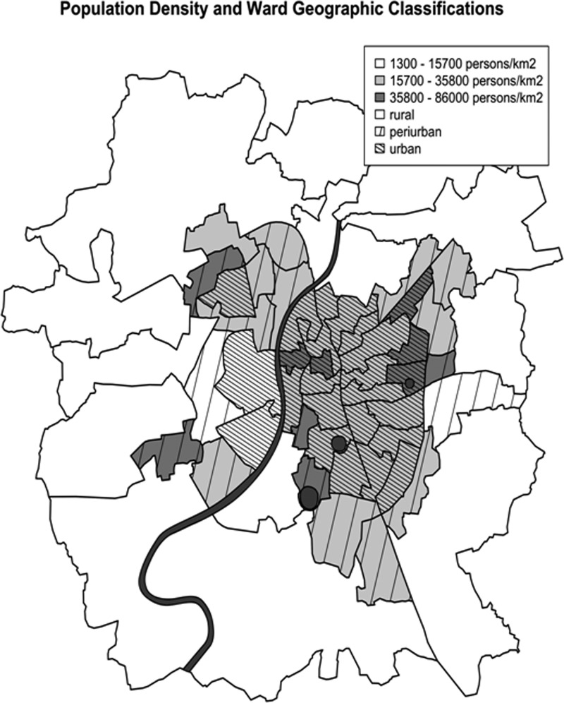
Figure 1.
Classification of population density (persons per km2) and ward geographic classifications based on location relative to the city's dense urban core and also considering the predominant land use type present in each ward (specifically urban vs. rural). Also included is the Sabarmati River that bisects the city and the three large urban lakes located in the eastern half of the city.

