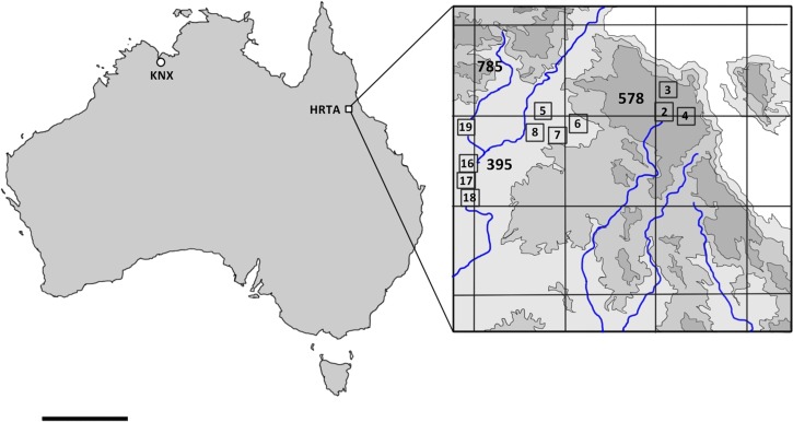
Figure 1.
Location of arbovirus surveillance mosquito trapping in Australia (left) and detail of survey area in vicinity of Harvey Range (right) based on the inset diagram from the Australian Defense Force Topographic Survey, 1:40,000 High Range Training Area (Special) (HRTA). The area is located in the vicinity of Dotswood, Queensland; −19.624423, 146.289802. Grid lines demarcate 10 × 10-km squares. Blue lines represent creeks. Numbers outside boxes in bold indicate height in meters above mean sea level. Numbers in small boxes indicate mosquito trap locations and correspond to trap numbers in Table 4. Four traps were located outside the topographic series map. KNX = trapping in vicinity of Kununurra, Western Australia; scale bar = 1,000 km.

