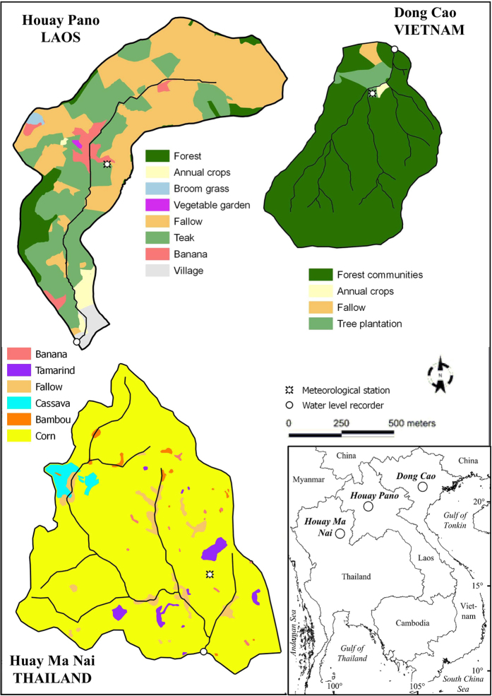
Figure 1. The three studied catchments of the MSEC network and their land use in 2015.
The land use maps were created with land survey data from the three sites using QGIS software (http://www.qgis.org/en/site/) and the map of Southeast Asia was created for this article with Microsoft Office Visio 2007.

