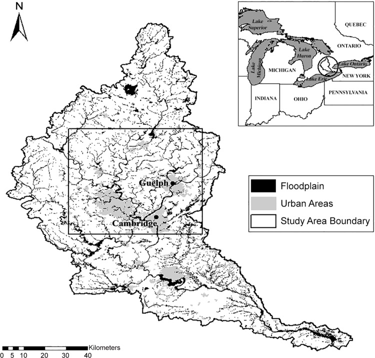
Fig 1. Map of the study area and Grand River Watershed in southern Ontario, Canada.
Study Area [map]. Data layers: Grand River Conservation Authority: floodplain, watershed boundary; Open Government License–Ontario: built up areas; Great Lakes Commission: Great Lakes States boundaries, main lakes, province boundaries [computer files]. University of Guelph, Guelph, ON: Generated by Kristin Bondo, August 21, 2015. Using: ArcMap [GIS]. Version 10.1, Redlands, CA: Esri, 2012.

