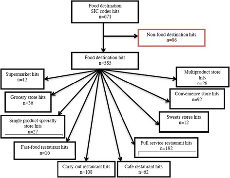
Fig. 2.

Hits* per food store destination type using ArcMap Closest Facility. Method for each 400 m walkshed. Figure 2 Legend: * Hits identify each food destination within each walkshed using the SIC codes. Hits allow one destination to be counted as many times as it appears (i.e. one food destination can be counted multiple times due to overlapping walksheds). SIC codes queried: 5399, 5411, 5421, 5431, 5441, 5451, 5461, 5499, 5541, 5812, and 5912
