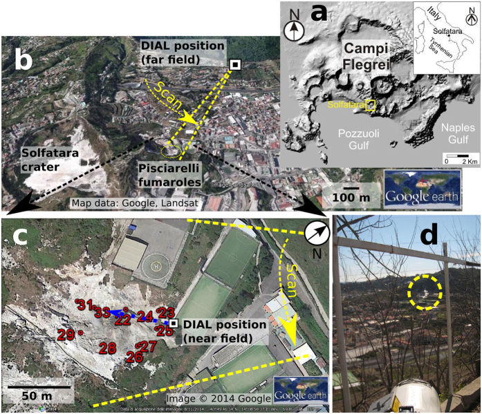
Figure 1. Geography of Campi Flegrei and overview of measurement sites.
(a) Location of Campi Flegrei (CF) close to Naples in Italy. Both maps were obtained using the open-access digital elevation model of Italy, TINITALY/0165. (b) Overview of the measurement geometry of this study showing the Solfatara crater and the Pisciarelli fumaroles (within dotted circle). The angular extension of the scan for the measurement of the Pisciarelli fumaroles is indicated as well as the scan direction (arrow). (c) Close up nadir view of the Pisciarelli fumarole field depicting the numbered locations were CO2 concentrations have been measured in situ using a LICOR analyser. The blue dotted line marks the path of the fixed angle acquisition with length 55 m. (d) Photo taken from the DIAL position showing the telescope aligned with the Pisciarelli fumarole (dotted circle).

