Fig. 5.

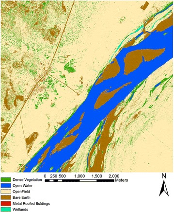
Land cover map based on WorldView 2 imagery covering the study site. The map shows the different land cover classes obtained from supervised classification and segmentation followed by manual correction to correctly delineate wetland sites

Land cover map based on WorldView 2 imagery covering the study site. The map shows the different land cover classes obtained from supervised classification and segmentation followed by manual correction to correctly delineate wetland sites