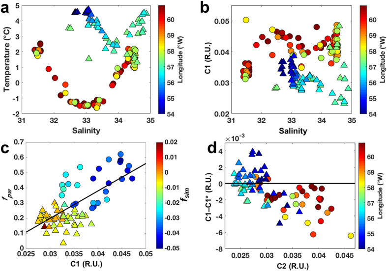
Figure 7. VIS-FDOM as a water mass tracer in the Davis Strait.
Plots for the Davis2013 cruise. (a) T-S diagram with longitude (°W) as colorbar. (b) Salinity vs. C1 (R.U.), with colorbar indicating longitude (°W). (c) C1 (R.U.) vs. fpw for the surface layer (<300 m) and fsim as colorbar. (d) C2 (R.U.) vs. C1–C1* (R.U.) for the surface layer (<300 m), with longitude (°W) as colorbar. Triangles indicate the samples within the eastern part of Davis Strait, whereas circles refer to samples located in the western sector (separated by the 57.5 °W longitude). Black line in (c) indicate the best fit.

