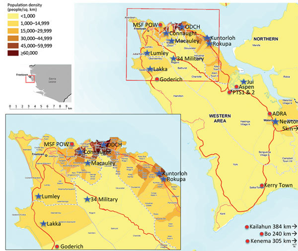
Figure 2.

Location of Ebola holding units (blue star) and Ebola treatment centers (red circle), Western Area, Sierra Leone, January 2015. Population density map source: MapAction (cited 2015 Nov 8); reproduced with permission. Population figures are projected for 2014 from the 2004 census (http://www.mapaction.org/?option=com_mapcat&view=mapdetail&id=3589)..
