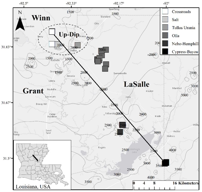
Figure 1.
Map of well locations sampled for this study. Contours on the map indicate depth (in feet; 1 meter = 3.28084 feet) to the top of the Wilcox Group in the region, and Louisiana parishes (i.e., counties) are labeled. The dashed circle indicates the locations of the 5 up-dip wells referred to here; the remaining non-circled wells are referred to as the down-dip oil fields/wells within the text. The black line (i.e., the transect) is approximately 65 km long.

