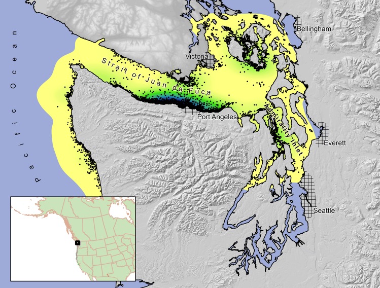
Fig 1. Study area used to examine resource selection by marbled murrelets in northwestern Washington and southwestern British Columbia, 2004–2008.
The marine 99% population-level kernel (from all radio-tracked murrelets) is depicted in yellow to green tones, where darker shading indicates areas with a high probability of use and lighter yellow shading areas with a low probability of use by the population of tagged murrelets. Black dots represent 5,388 marine telemetry locations from all murrelets tracked in this study.

