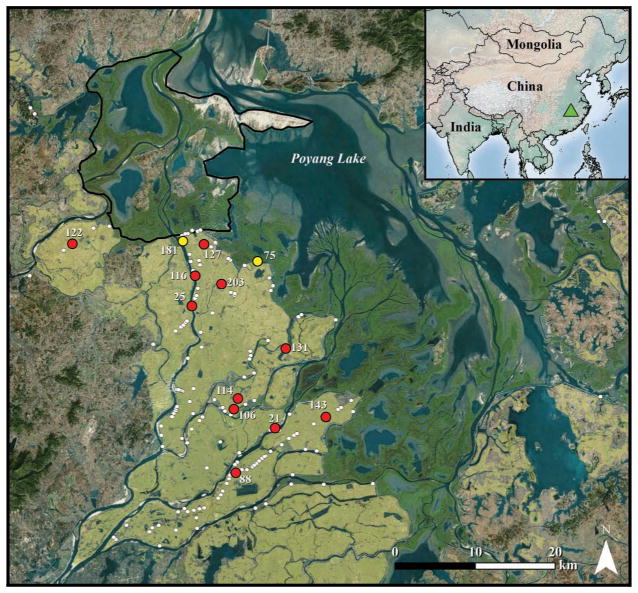
Figure 1.
Map of Poyang Lake area with free-grazing domestic duck shelters surveyed in October 2007 is shown in white. Farms with marked birds are shown in red (farms > 1.5 km from natural wetlands) and yellow (border farms) and labeled by farm number. Green triangle in inset indicates relative location of Poyang Lake within China. Dark green areas bordering southern edge of Poyang Lake indicate natural wetland. Tan shading indicates rice paddy habitat. Black outline delineates the Poyang Lake National Nature Reserve. Base imagery source: ESRI, DigitalGlobe, GeoEye, i-cubed, Earthstar Geographics, CNES/Airbus DS, USDA, USGS, AEX, Getmapping, Aerogrid, IGN, IGP, swisstopo, and the GIS User Community, 2015.

