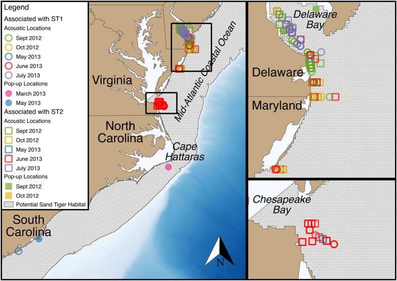
Figure 1. Map of acoustic detection locations and Pop-up Satellite Arcival Tag pop-up locations associated with sand tigers Carcharias taurus ST1 and ST2 from September 2012 to July 2013 along the East Coast, USA.
Locations represent primary, secondary and tertiary locations (see Supplemental Material and Methods for details). Potential sand tiger habitat represents waters <200 m40. Map was created using QGIS version 2.8.3 (www.qgis.org), and includes bathymetry data from Amante and Eakins48.

