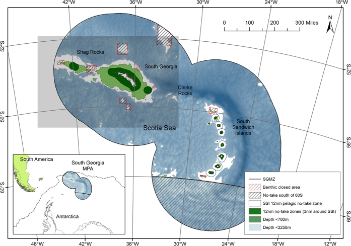
Figure 1. The South Georgia and South Sandwich Island marine protected area.
Dark green areas demark the no-take zones around South Georgia, South Sandwich Islands, Shag Rocks and Clerke Rocks. Light green indicates depths less than 700 m in which bottom fishing is prohibited. Hashed boxes with red border are additional benthic closed areas established in 2013 in which bottom fishing is prohibited. The purple borders around SSI are a 12nm pelagic no-take zone. The large black hashed area south of 60° S falls within the SGSSI Maritime Zone in a region for which no fishing licenses are issued. In all other regions of the SGMZ bottom fishing is prohibited with the sole exception of the narrow pale blue region which includes the depths between 700m and 2250m. Within this region bottom fishing is permitted by license. The region of interest for this study is delineated by the grey shaded box. The inset shows the position of the South Georgia and South Sandwich Islands MPA relative to South America, the Antarctic continent and the Polar Front (dashed line). Figure was created using ArcGIS (version 10.1 [www.esri.com/software/Arcgis]). Background bathymetry is The GEBCO_2014 Grid, version 20141103 (http://www.gebco.net).

