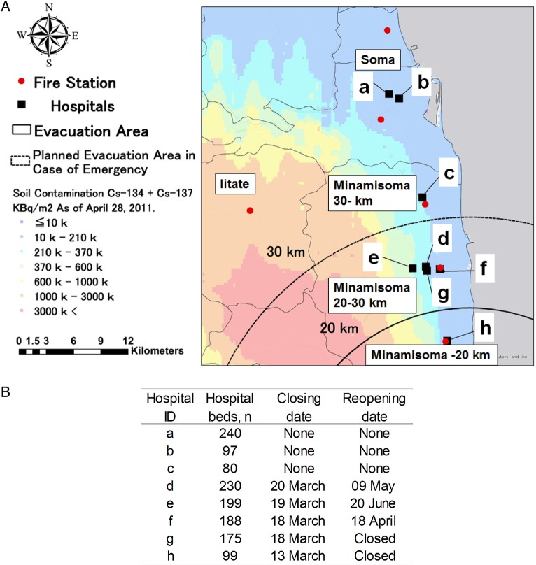
Figure 1.
(A) Five regions of the study area according to evacuation orders by the government after the nuclear accident; (1) Minamisoma, within 20 km of the plant; the area under mandatory evacuation orders after 12 March 2011, (2) Minamisoma, 20–30 km from the plant; designated as a voluntary evacuation area from 15 March to 22 April 2011, (3) Minamisoma, further than 30 km from the plant; under no evacuation orders, (4) Iitate; a rural mountain area located 25–45 km northwest of the nuclear plant, under mandatory evacuation orders after 11 April 2011 and (5) Soma; an area located more than 40 km to the north from the plant, under no evacuation orders. (B) The periods of hospital closures. Each letter corresponds to the hospital ID in (A). Source: Esri, HERE, DeLorme, MapmyIndia, © OpenStreetMap contributors, and the GIS user community.

