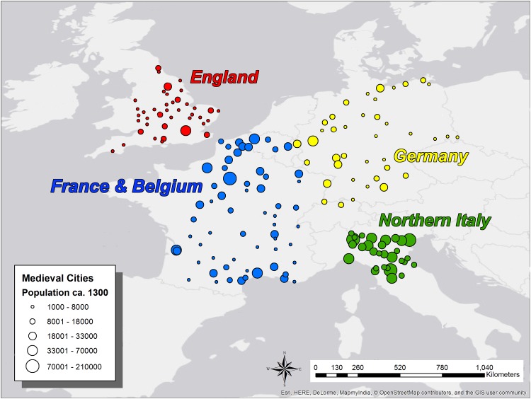
Fig 2. Map of Western European Settlements ca. 1300 CE Examined in this Paper.
Medieval towns and cities of Western Europe ca. AD 1300 examined in this paper (n = 173), in England (red; n = 40), France and Belgium (blue; n = 63), Northern Italy (green; n = 30) and Germany (yellow; n = 40). All settlements examined have populations of >1,000, and in most cases have populations >5,000. This map was created using ArcGIS® software by Esri, © OpenStreetMap and contributors, Creative Commons-Share Alike License (CC-BY-SA).

