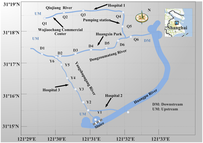
Figure 3. Three main urban rivers and sampling sections in Yangpu District, Shanghai, China.

The figure was created by Haidong Zhou using Visio 2007 (Version: Microsoft Office Visio 2007 (12.0.4518.1014) MSo (12.0.4518.1014), https://products.office.com), and the base maps in this figure were generated by Haidong Zhou and Xuelian Wang using the software MapGIS (Version: MapGIS 6.7 build 041010, http://www.mapgis.com.cn (http://english.mapgis.com.cn/en/ for English)).
