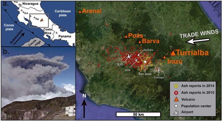
Figure 1.

(a) Tectonic setting of Turrialba Volcano (orange triangle). Grey triangles indicate other volcanoes of the Central American Arc, and the grey box indicates the area shown in Figure 1c. (b) Explosive eruption at Turrialba on 12 March 2015, as captured by an OVSICORI webcam located on the summit of Irazú Volcano. (c) Location map of Turrialba Volcano in Costa Rica relative to the cities and airports (SJO: San José International Airport and SYQ: Tobias Bolaños International Airport) of the densely populated Central Valley, as well as volcanoes of the Cordillera Central. Hollow circles indicate reports received at OVSICORI of ash fall in 2014 (yellow) and in 2015 (red).
