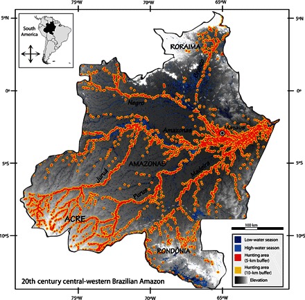
Fig. 5. Two hypothetical hunting area scenarios displayed against terrestrial and aquatic habitats in the central-western Brazilian Amazon during the mid-20th century.

Hunting catchment areas were obtained from 5- and 10-km buffer radii (red and yellow, respectively) around 3298 historical settlements in the 1950s and 1960s. These are predominantly nonindigenous settlements; locations of indigenous settlements in this period are mostly unknown. Low- and high-water seasons (dark and light blue, respectively) were reclassified from available raster imagery (48) for the focal area. Dashed lines delimit Brazilian state frontiers (state name in upper case). River names are in italic bold. See Materials and Methods for further details of the spatial analyses performed.
