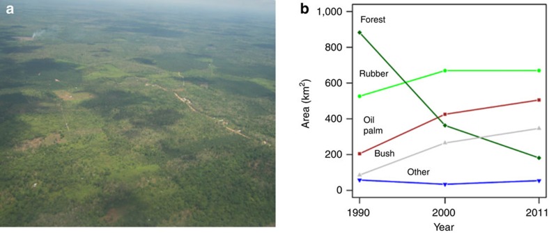
Figure 1. Land-use change in smallholder-dominated mosaic agricultural landscapes.
Aerial photo (Photo: Heiko Faust) (a) and changes in the land-use composition (b) of the studied landscapes around the national park Bukit Duabelas and the Harapan Forest Restoration concession in Jambi Province, Indonesia from 1990 to 2011, based on land-use classification inferred from remote sensing. Rainforest (dark green diamonds), rubber (light green filled circles), oil palm (red squares), shrub/bushland (grey up-pointing triangles), and ‘others' (blue down-pointing triangles), which includes amongst others food crops, timber and fruit tree plantations. See Table 1 for the 1990–2011 land-use change matrix.

