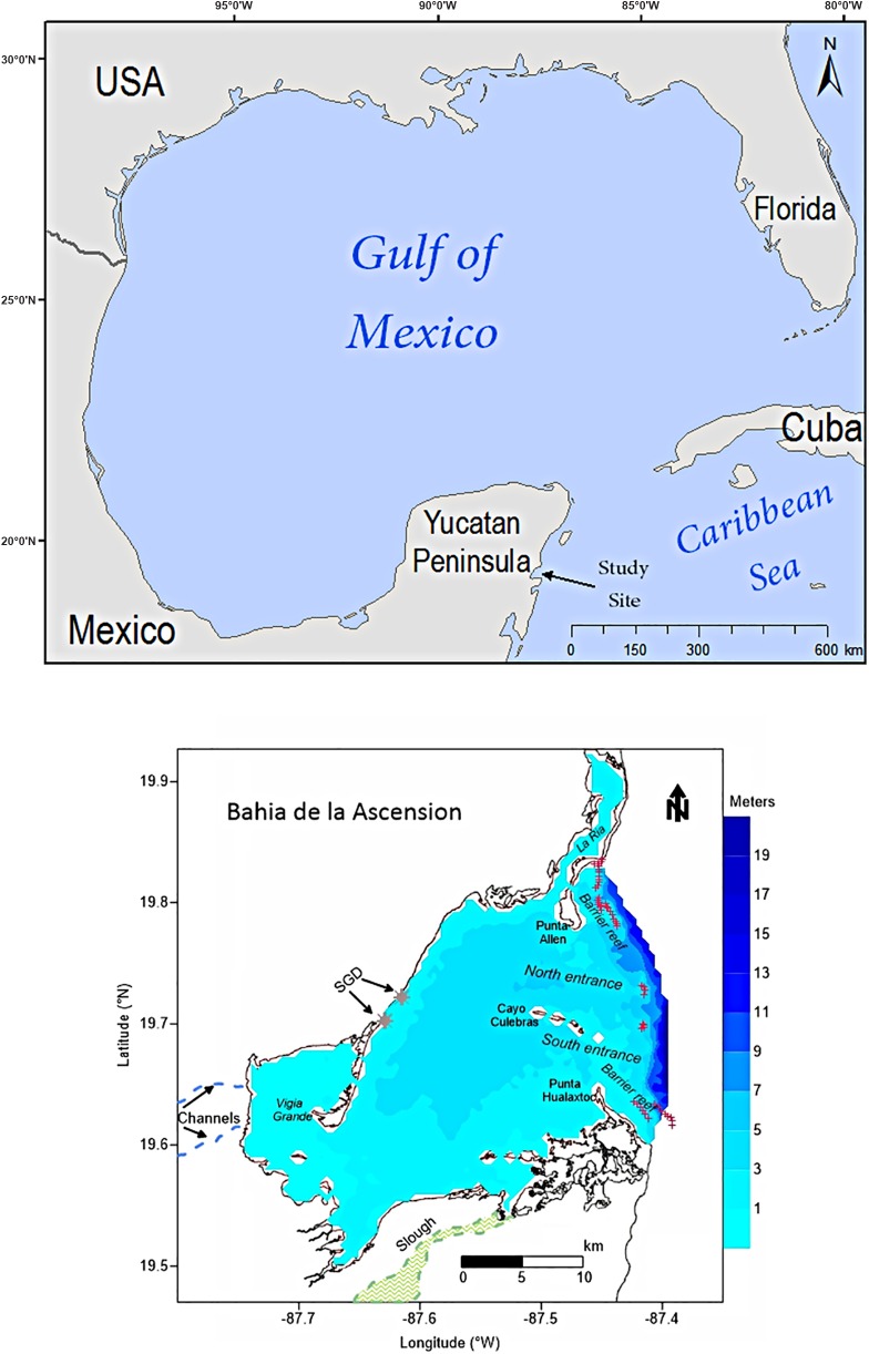
Fig 1. (above) Map of Gulf of Mexico showing the location of the study site (arrow). (below) Bahia de la Ascension in the Western Caribbean with bathymetry (meters).
Main geomorphologic features within the system are shown, along with coral reef formation at the seaward boundary. Freshwater sources into the bay are depicted (SGD: submerged groundwater discharges).

