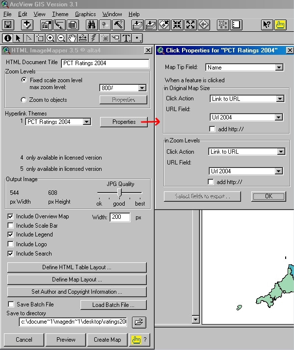
Figure 4.

Screenshot of the Demo version of HTML ImageMapper 3.5 extension within ArcView GIS 3.1. Screenshot of the evaluation version of alta4 HTML ImageMapper 3.5 extension within ESRI ArcView GIS 3.1, showing the main settings we have used to generate our Web-based 'PCT Ratings 2004' interactive map set. The dialogue box on the right shows the 'MapTip Field' and 'Click Action/URL Field' settings associated with features (PCTs) on the output map.
