
FIG 1 .
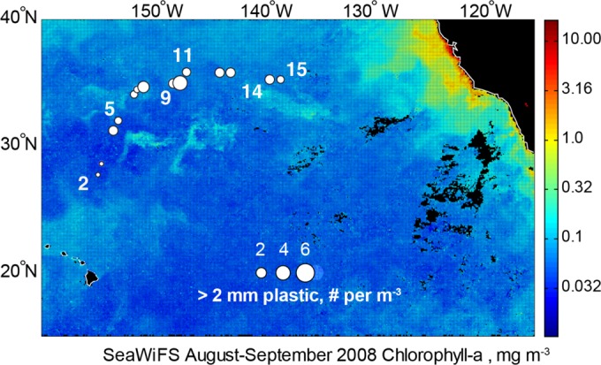
Locations of sampling stations along our transect. The area of each circle corresponds to the concentration of plastic particles with a diameter of >2 mm. Station numbers are next to the stations where samples used for molecular analyses were collected. Composite satellite SeaWiFS measurements of sea surface Chl a (up to a depth of approximately 25 m) from August and September 2008 are shown for context. For reference, the center of the NPSG accumulation zone is at 31°N, 139°W (10).