
Fig. 1.
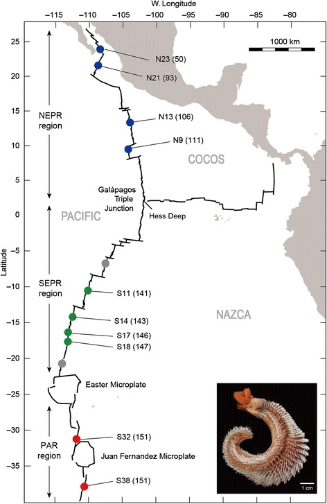
Map of the eastern Pacific ridges and Alvinella pompejana sampling locations along the ridge axes. Colored dots indicate sampled vent field locations: blue, green and red dots, sampling sites within the NEPR, SEPR and PAR regions. Gray dots represent records for A. pompejana but were not included in this study. The numbers in parenthesis following the locality names indicate tectonic spreading rate (mm/year). Inset photo of A. pompejana was supplied courtesy of G. W. Rouse, Scripps Institution of Oceanography, UCSD. Photo was taken from sample collections of the Alarcón Rise