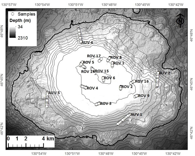
Fig 2. The location of submersible-collected images (circles) on Cobb Seamount.
The imagery of the shallow seamount summit (<211 m) was collected using a remotely operated vehicle (ROV) while the imagery of the deeper flanks was collected using an autonomous underwater vehicle (AUV). Point locations of the images analysed are overlaid on shaded multibeam bathymetry where contour lines represent 100 m depth intervals.

