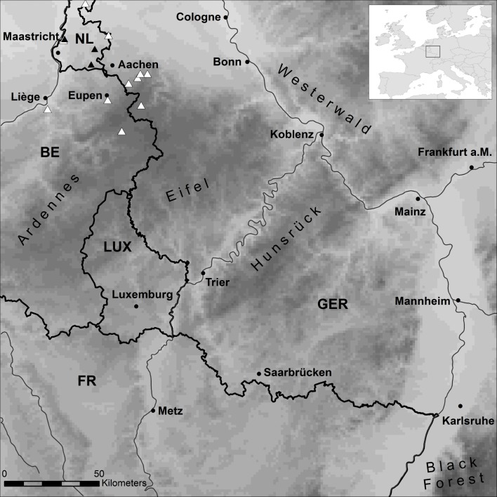
Fig 1. Western Europe study region.
First noted Bsal outbreaks are indicated by black and subsequent records by white triangles. Elevational range (grey scales, light to dark: 28–1,050 m a.s.l.), borders (bold lines), rivers (thin lines), some major cities (normal font) and low mountain range names (sloped font) are shown.

